stewardship

Riparian Areas

What on earth is a “riparian”? A riparian area or zone refers to the interface between land and freshwater, including streams, rivers, lakes, and estuaries. This strip supports an incredible diversity of aquatic and terrestrial plants and animals. As illustrated below, a fully functioning riparian area benefits everyone. However, unsurprisingly, human activity and development has significantly degraded and erased healthy riparian areas. With education and awareness about the problems and how we can solve them, these important ecosystems can be restored to their natural and functioning state. What does a healthy riparian area look like? We are accustomed to seeing modified riparian zones. By law, the riparian zone is defined as 30 m from the waters edge, and if left untouched, should naturally transition from sedges and rushes to large evergreen trees as shown in the diagram below. Riparian flora consists of Herbaceous and aquatic plants, such as rushes, sedges, cattails, skunk cabbage and pond lilies that grow in and immediately adjacent to the water. Shrubs such as willows, red-osier dogwood, hardhack and salmonberry, which grow next to the water along banks. Trees such as western red cedar, black cottonwood and red alder, which can grow some distance back from water bodies, but require moist soils. Source: https://www.crd.bc.ca/education/our-environment/ecosystems/freshwater/riparian-zones But grass is considered natural vegetation right? But grass is considered natural vegetation right? Maintaining a lawn to the edge of the water has many repercussions. Without a buffer of deeply rooted native vegetation, the bare riparian area is susceptible to erosion, flooding, and greedy invasive species. Lawn just doesn’t cut it. But I want to be able to see the water! Large trees play an essential role in riparian areas as their roots filter enormous amounts of water and runoff, and they provide shade and protection for the lake and its inhabitants. One way to maintain a view, if that is a priority, is to plant large trees densely on the sides of your property (in the case of lakefront land) and more sparsely in the area looking out over the water. An eroded stream bank due to complete lack of deeply rooted vegetation in the riparian area.   What can you do to help? Leave a large vegetated buffer between water and land Nurture and plant large trees on your property Remove invasive species such as Himalayan blackberry Reduce the size of your lawn and plant native shrubs and grasses instead Don’t use herbicides, pesticides, or fertilizers near the riparian area Dispose of substances such as oil and soapy water in the proper area – not down a storm drain If you’re interested in how you can help the riparian area on your property or elsewhere, we would be happy to talk with you over the phone (250)710-0227, or by email at info@cowichanlandtrust.ca. We have many resources regarding topics such as invasive removal, bank stabilization, and native planting and livestaking. RAR (Riparian Area Regulations) Before making any changes within 30m of any wetland on your property, you will need to consider the RAR in place for your area. Click here for more info on how the regulations affect you and your property: https://www2.gov.bc.ca/assets/gov/environment/plants-animals-and-ecosystems/fish-fish-habitat/riparian-areas-regulations/rar-brochure-2016_final_web.pdf 

Riparian Areas Read More »

,

Caring for Our Shores – Appendix 1: Where to Get Help

Caring for Our Shores – Appendix 1: Where to Get Help Report and Information Hotlines (please note: all contact information was correct at time of printing but may no longer be valid) Enquiry Lines: Federal Government Enquiry Line: 1-800-667-3355, provides contact numbers for federal agencies (does not transfer calls). Enquiry B.C Transfer Line: 1-800-663-7867, will transfer your call to the appropriate agency or contact person. Department of Fisheries and Oceans (DFO): Emergency Hotline: 1-800-663-9453 (24 Hours) Observe Record & Report Hotline: 1-800-465-4336 Shellfish Information: Includes red tide updates, (604) 666-2828 (24 Hours) Marine Mammal Sightings or Animals in Distress: Reporting marine mammal sightings provides information that aids scientists in tracking the movements and health of certain populations. The more detailed information you can provide the better. Cetacean sightings (whales and dolphins), DFO, Pacific Biological Station, Nanaimo, Graeme Ellis, 756-7245. Pinniped sightings (seals and sea lions), DFO, Pacific Biological Station, Nanaimo, Peter Olesiuk, 756-7253. For live strandings or animals in distress, do not approach the animal or attempt to “rescue” it. Call Vancouver Aquarium (604) 685-3364, or page their marine mammal coordinator (Clint Wright) at (604) 686-9637. Alternately, call the DFO 24 hr Emergency Hotline 1-800-663-9453 (they will page Graeme Ellis, Peter Olesiuk, or someone else to help you). Ministry of Environment, Lands, and Parks (MELP): Seaweed Harvesting Permits: Courtenay, Ed Black, 897-7540. Provincial Emergency Response: 1-800-663-3456 (24 Hours) B.C Environment Report Line: 1-800-663-9453 (24 Hours) To report violations of environmental law, including freshwater fishing violations, illegal wildlife kills, and disposal of hazardous materials into streams. B.C Environment Planning and Assessment: 1-800-665-7027 Oil Spills (Pacific International Number): 1-800-OILS-911. Links caller to the appropriate state or provincial emergency dispatch services. The intended users are fishermen, recreational boaters, and other mariners who travel between west coast states and the province. Call via radio-telephone, cellular phone, pay-phone, or regular phone. Rare Bird Alert: A hotline for interested birders to report sightings of rare birds on Vancouver Island, or birds outside their normal habitat range. 592-3381. Certified Laboratories of Vancouver Island (for shellfish and water testing) M.B. Research and Development Ltd., Sidney, 656-1334 North Island Laboratories, Courtenay, 338-7787 Sewage Alternatives: Composting Toilets: Spiral Marketing, (604) 882-9493 Cisterns: Forest Lumber Company, 642-4899 Wastewater Treatment Systems: Engineered Pump Systems Ltd, (604) 584-3154 British Columbia Recycling Hot Line: 1-800-667-4321 Search and Rescue or Diver Distress: 1-800-567-5111 Canadian Environmental Assessment Agency: (604) 666-2431 Specific Contacts in the Cowichan/Nanaimo Area If you are outside the CVRD or Nanaimo areas, contact the corresponding person in your blue pages or call the government enquiry numbers listed above and ask for a local reference. Harvesting Permits: (Cowichan First Nations permits for food use) Cowichan Band Office, Wayne Paige, 748-3196. (Shellfish and finfish licencing information) DFO Nanaimo, 754-0400. Harvesting and Marine Fishing Violations: DFO Duncan, Linda Watkin (clerk), Elliot Teskey or Willi Jansen (Fisheries Officers), 746-6221. Department of Fisheries and Oceans Hotline, 1-800-465-4336. Regional Red Tide Updates: DFO Duncan, Linda Watkin (clerk), Elliot Teskey or Willi Jansen (Fisheries Officers), 746-6221. Property Development Questions: CVRD Planning Department, Dave Paras & Cheryl Weirz (Planning Tehnicians) DFO Habitat Management (Ladysmith to Sooke) Cindy Harlow (Habitat Technologist) 748-0278 MELP Duncan, Marlene Caskey (Habitat Protection Technician) 746-1224 Foreshore issues (DFO), Rob Russell, 756-7159 Water quality issues (DFO), Margaret Wright, 756-7269. Environmental Impact Assessments: MELP Nanaimo, Ron Bollans, 756-3100. Septic Issues: Public Health Inspector Duncan, 746-1414. Soil Testing: Vancouver Island Soil Testing Associates, Duncan, 746-8633. Land Use Violations: MELP Nanaimo, Keith Anderson (Senior Officer), 751-3100. Illegal Dumping: MELP Nanaimo, Diane Tetarenko (Conservation Officer), 751-3100. Hazardous Materials: Discharge into streams: MELP Duncan, Ken Broadland (Conservation Officer), 746-1257. Discharge into storm drains or fish kills: DFO Hotline, 1-800-465-4336. CVRD Recycling Hotline: Duncan, 746-2640, Ladysmith (toll-free) 1-800-665-3955. CVRD Website: http://www.cvrd.bc.ca Paint Collection Depot (phone before dropping off paint): Cowichan Valley Bottle Depot Duncan, 748-2066 Pharmaceuticals (including over the counter drugs, vitamins or prescription drugs) can be returned to any pharmacy in British Columbia. Government Organizations Agriculture and Agri-food Canada: Coastal Areas Branch, Box 2527, 103-620 Royal Avenue, New Westminster, B.C, V3L 5A8, Phone: 604-666-9283. (http://res.agr.ca/neri/) Canadian Wildlife Service: (Publications) Ottawa, ON, K1A 0H3, Phone: 819-997-1095 Conservation Data Centre: Ministry of Environment, Lands, and Parks, Resources Inventory Branch, Box #9344, Station Provincial Government, Victoria, B.C, V8W 9M1. Phone: 356-0928. Cowichan Valley Regional District: 137 Evans Street, Duncan, B.C, V9L 1P5, Phone: 746-2500, Fax: 746-5612. Department of Fisheries and Oceans (DFO): Institute of Ocean Sciences: 9860 West Saanich Road, Box# 6000, Sidney, B.C, V8L 4B2, Phone: 363-6518, Website: http://www.ios.B.C.ca. Pacific Biological Station: Hammond Bay Road, Nanaimo, B.C, V9R 5K6, Phone: 756-7000, Website: http://www.pbs.dfo.ca. Habitat and Enhancement Branch: Fisheries and Oceans Canada, 555 West Hastings St. Vancouver, B.C, V6B 5G3. Coastal and Marine Habitat Science Website provides scientific advice and information about marine habitats, particularly needed for managing, conserving and protecting our Pacific coastal zones. Can be accessed through the Institute of Ocean Sciences at http://www.ios.B.C.ca/ios.mehsd/coast/welcome.htm Environment Canada: 2224 West Esplanade, North Vancouver, B.C, V7M 3H7, Main Office: 604-666-6711, Library: 604-666-5914, General Information: 604-666-5900, Website: http://www.ec.gc.ca. Islands Trust: 2nd Floor, 1627 Fort Street, Victoria, B.C, V8R 1H8, Phone: 387-4000, Fax: 387-4047. Ministry of Environment Lands and Parks (MELP): Nanaimo: 2080 Labieux Road, Nanaimo, B.C, V9T 6E9, Phone: 751-3100, Fax: 751-3103 Victoria: 103-3179 Jacklin Road, Victoria, B.C, V8V 1X4, Phone: 474-5544, Fax: 474-6756 Municipal/Regional Planning Department: For more information about what measures your local government may have taken to protect marine habitat, and more information about Environmentally Sensitive Areas and Development Permit Areas, contact your local municipal/regional office, planning department. Naturescape British Columbia: Ministry of Environment, Lands, and Parks, #300-1005 Broad Street, Victoria, B.C, V8W 2A1, 1-800-387-9853. Purpose: Publishes “Naturescape” series for practicing stewardship at home. First Nations Cowichan Tribes, Box 880, 1820 Tzouhalem Rd., Duncan, B.C, V9L 3Y2, Phone: 748-3196, Fax: 748-1233. Halalt First Nation, RR #1, Chemainus, B.C, V0R 1K0, Phone: 246-4736, Fax: 246-2330. Homalco First Nation, 1400 Weikaikum Road, Campbell River, B.C, V9W 5W8, Phone: 287-4922, Fax: 287-9590. Lyackson First Nation, 5360 Smith Road, RR #6, Duncan, B.C, V9L 4T8, Phone: 246-5019, Fax:

Caring for Our Shores – Appendix 1: Where to Get Help Read More »

, , ,

Caring for Our Shores – Section IV: The Law and the Shore

Caring for Our Shores – Section IV: The Law and the Shore Who Regulates What? Every part of British Columbia’s coastline falls under the jurisdiction of one or more of the following levels of government: municipalities, regional districts, First Nations Peoples, provincial, or federal government. Private property extends only as far as the mean ordinary high tide mark.   Back to Index Ahead to Appendix 1: Where to Get Help   To order a copy of Caring for Our Shores: A Handbook for Coastal Residents in the Strait of Georgia, contact: The Cowichan Community Land Trust Society #6-55 Station Street, Duncan, B.C, V9L 1M2 P: 250-746-0227, F: 250-746-9607 The Marine Ecology Station Sidney, B.C, P: 250-655-1555 Images used with special permission from Kerry L. Werry. To view more pictures of ocean creatures found in B.C waters, visit the B.C Diving and Marine Life I.D Page.

Caring for Our Shores – Section IV: The Law and the Shore Read More »

, , ,

Caring for Our Shores – Section III: Mapping and Monitoring

Caring for Our Shores – Section III: Mapping and Monitoring Imagine that when you bought your land the previous owners passed on a series of maps, charts, and surveys that marked thriving clam and oyster beds, stands of sea asparagus, seal haul-outs, and eagle trees. You would have been able to make informed decisions about your new property: where to place your beach paths and docks, how to orient your sundeck for the best view. You would also have known about sensitive populations of wildlife that shared your land and how to avoid harming them. That kind of information is not only a communication from one landowner to the next, it is a powerful tool. For instance, when cartographers surveyed the Georgia Strait in the 1700s, they measured depths of water along the coast, significant kelp forests and oyster beds, and unique land ecosystems such as the prairie meadows on Cortes Island. Today we can use their findings as a scale of how things were and to understand how far we must go to put things back in order.   Back to Index Ahead to Section IV: The Law and the Shore   To order a copy of Caring for Our Shores: A Handbook for Coastal Residents in the Strait of Georgia, contact: The Cowichan Community Land Trust Society #6-55 Station Street, Duncan, B.C, V9L 1M2 P: 250-746-0227, F: 250-746-9607 The Marine Ecology Station Sidney, B.C, P: 250-655-1555 Images used with special permission from Kerry L. Werry. To view more pictures of ocean creatures found in B.C waters, visit the B.C Diving and Marine Life I.D Page.

Caring for Our Shores – Section III: Mapping and Monitoring Read More »

, , ,

Caring for Our Shores – Chapter 3: Let Nature Do the Work

Caring for Our Shores – Chapter 3: Let Nature Do the Work …how to minimize harm through careful building and landscaping Some of the largest alterations we can make to our properties are structural: digging fields for septic systems or channels for water pipes, clearing land for lawns and views, paving, roofing, and removing trees. Although many of these things help us to enjoy our property, they may also lead to potential problems through increased run-off and erosion. Impervious Surfaces Each time we pave or cover an area with impervious surfaces, we give run-off more travelling distance to cross before it drains into the ground; this reduces infiltration and increases evaporation, lessening the amount of potential groundwater. We also provide it with a smooth place to collect and gather speed. While a little bit of run-off might have passed through your property unnoticed, greater amounts sweep away soil, causing rills and cracks to develop. Run-off from agricultural or urban areas carries pollutants harmful to groundwater and wildlife; concentrated in large amounts, these can affect your health and the health the shore. Reducing Impervious Surfaces Reducing the amount of pavement on your property will help stop concentrated run-off from becoming a problem. If you are building a new house, choosing a taller, multi-storied design instead of a sprawling single level means less ground occupied by roofing. Development Upland development affects the drainage of surface and groundwaters by impeding its natural flow or giving it an “easier” route (in the case of buried pipes). Cleared land means less vegetation to act as a buffer against erosion. Not only that, but without the cyclical decomposition of roots, leaves, and organic matter present in forested land, your soil quality degrades rapidly. The ability of poor soil to hold water and nutrients is negligible. Shoreline Structures To lessen the impacts of erosion, landowners often erect shoreline structures such as breakwaters, jetties, seawalls, groins, and bulkheads. Some of these actually worsen the problem by disturbing patterns of sediment and nutrient transport or shifting the erosion problem down shore. Seawalls and bulkheads can also eliminate important shallow water habitats and affect water exchange with salt marshes. Natural Buffers Shoreline trees and vegetation perform a vital function: they absorb quantities of water that might otherwise erode banks, taking up excess nutrients and toxins before they reach the sea. They also anchor soil to the substrate and provide stability in steep places. To protect the shore against erosion, try obtaining some of the plants naturally found on your banks from your local native plant nursery. Some native vegetation particularly good at preventing seashore erosion includes: snowberry (deciduous, 0.5-2 m) salal (evergreen, 0.2-5 m) ocean spray (deciduous, to 4 m) evergreen huckleberry (evergreen, to 4 m) bigleaf maple (deciduous, to 35 m) willow (deciduous, 1-12 m tall) yew (evergreen, 2-15 m) native plant seed mixes (grasses, deciduous, 0.5-1.5 metres)   Back to Index Ahead to Section III: Mapping and Monitoring the Shore   To order a copy of Caring for Our Shores: A Handbook for Coastal Residents in the Strait of Georgia, contact: The Cowichan Community Land Trust Society #6-55 Station Street, Duncan, B.C, V9L 1M2 P: 250-746-0227, F: 250-746-9607 The Marine Ecology Station Sidney, B.C, P: 250-655-1555 Images used with special permission from Kerry L. Werry. To view more pictures of ocean creatures found in B.C waters, visit the B.C Diving and Marine Life I.D Page.

Caring for Our Shores – Chapter 3: Let Nature Do the Work Read More »

, , ,

Caring for Our Shores

“Caring for Our Shores: A Handbook for Coastal Landowners in the Strait of Georgia” by Shannon Cowan, Christy Wilson, and Bill Austin; published by the Cowichan Community Land Trust (Cowichan Intertidal Stewardship Project) and the Marine Ecology Station. This book is available from CCLT for $10 (plus postage and handling) for individual copies or $6 (plus postage and handling) for bulk orders from environmental organizations who wish to sell or redistribute them. For more information or to order contact CCLT This is the online summary of Caring for Our Shores: A Handbook for Coastal Landowners in the Strait of Georgia. The handbook is written for private landowners living on marine waterfront who want to preserve and maintain a healthy seashore. It is an introduction to marine wildlife in the protected waters of the Strait of Georgia, British Columbia, Canada, and a look at some of the positive things we can do to protect the shore. Because waterfront property is an attractive place to live, many of our activities concentrate along the shoreline. The beach is a place to relax, to harvest wild foods, and to appreciate spiritual and aesthetic values. It is also a place where a delicate band of wildlife depends on a unique habitat for survival. This habitat–called the intertidal zone–can be very sensitive to activities that occur on adjacent lands. Taking care to protect this fragile place on the edge of our properties is a form of stewardship. Click here to see the Table of Contents and browse through some of the book. Visit the Intertidal Stewardship Project page to learn more about that project. To order a copy of Caring for Our Shores: A Handbook for Coastal Residents in the Strait of Georgia, contact: The Cowichan Community Land Trust Society #6-55 Station Street, Duncan, B.C, V9L 1M2 P: 250-746-0227, F: 250-746-9607 The Marine Ecology Station Sidney, B.C, P: 250-655-1555 Images used with special permission from Kerry L. Werry. To view more pictures of ocean creatures found in B.C waters, visit the B.C Diving and Marine Life I.D Page.

Caring for Our Shores Read More »

,

Stewardship Progression Evaluation Report

This report is the result of a research project funded by Habitat Conservation Trust Fund, the Cowichan Valley Regional District and the Kaatza Foundation. During this project CCLT land stewards from 11 years of landowner contact programs were surveyed to assess the effectiveness of stewardship education. Land stewards were interviewed to determine what changes in land use practices and other environmentally relevant behaviours occurred and/or resulted from the landholder’s experience with these stewardship initiatives. It is hoped that this study will be helpful to other conservation organizations engaged in similar stewardship activities and will help to identify areas of landowner contact that require more continuity and long-term, consistent support. Click here to view or download the report as a PDF.

Stewardship Progression Evaluation Report Read More »

,

Conservation Tools

The Stewardship Pledge The Stewardship pledge is a voluntary commitment of landholders to: Conserve the natural elements in the area and be sensitive to the wildlife (both plants and animals) that live there. Keep to a minimum any disturbance to the natural features and seek conservation assistance, if required. Encourage a diversity of native plants and animals, especially those that are rare and threatened, where possible. If transferring your property, notify the new landholders) or manager(s) of the commitment and encourage a fellow Steward to contact them. The strength of the pledge rests on the landholder’s personal commitment Conservation Covenants One of the main activities of the CCLT is to help private landholders protect their land through the use of conservation covenants. A conservation covenant is a voluntary, written agreement between a landholder and a conservation organization such as CCLT. In such an agreement the landholder promises to protect the land in specified ways. The covenant can include all or just a portion of a landholder’s property. It may include provisions to protect natural, historical, cultural, architectural, environmental, heritage, scientific, wildlife, or plant-life values. More on conservation covenants: Land Trust Alliance of BC Turtle Island Earth Stewards Westcoast Environmental Law Public Education CCLT is committed to providing educational workshops to the community at large on a varitey of topics including. CCLT will also assist special interest groups organize their start-up activities. Visit Westcoast Environmental Law for excellent descriptions of: Donation of funds or land Land Acquisition More Look for a number of publications including: “Greening Your Title: A Guide to Best Practices for Conservation Covenants” (pdf — text version available at site) West Coast Environmental Law announces the second edition of Greening Your Title: a Guide to Best Practices for Conservation Covenants Additional information can be found at: The Green Lane: [Backgrounder] — Ecological Land Donations – Qualified Registered Charities in British Columbia Canadian Wildlife Service – Ecological Gifts: A Checklist for Donating Ecologically Sensitive Land in Canada

Conservation Tools Read More »

, , ,

Protecting rare, endangered Garry Oak and Associated Species Ecosystems

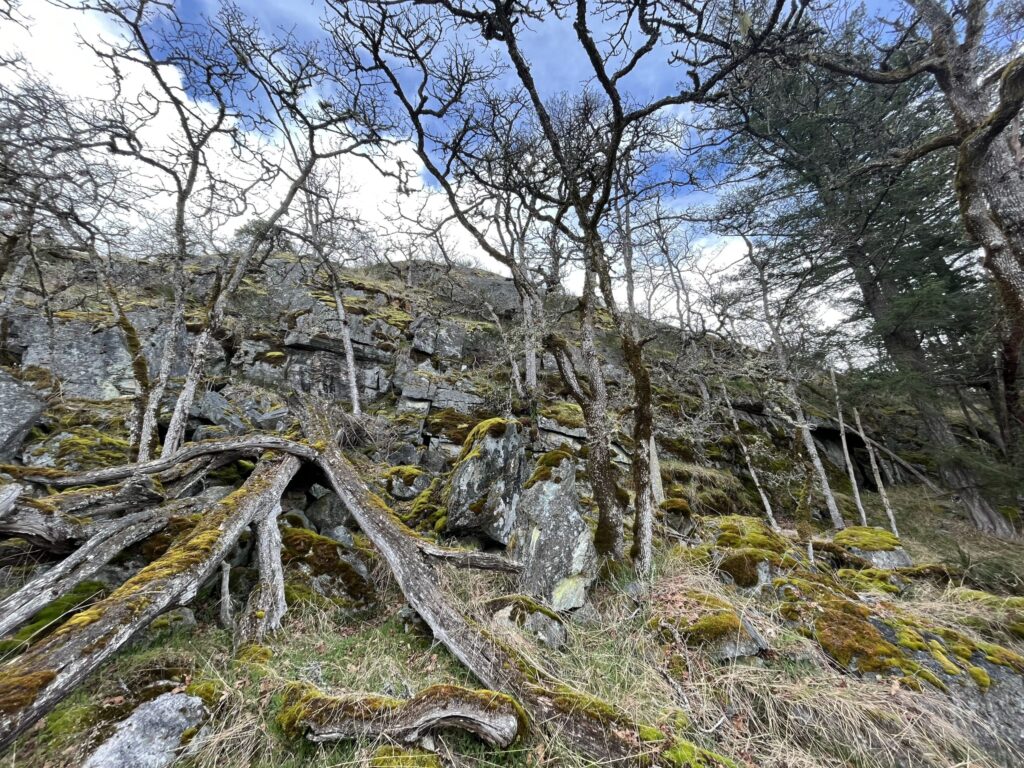
Protecting rare, endangered Garry Oak and Associated Species Ecosystems Garry Oak Meadow with Great Camas (Camassia leichtlinii) Albino Flower. Credit: R. WilesWe are excited to share about our activities growing awareness and stewardship of the special and endangered Garry Oak ecological community on Maple Mountain! We’ve been collaborating with the BC Conservation Federation (BCCF), the Province of BC, and the Municipality of North Cowichan to develop what we plan to be a long term program focusing on caring for this special ecosystem this region is blessed with. This will include a dedicated web page coming soon! Maple Mountain is home to endangered Garry Oak and Associated Species Ecosystems that have been identified as a priority for conservation. In the recent past, unique Garry Oak and Associated Ecosystems thrived over 60-70% of Maple Mountain. This unique habitat provided abundant food and resources to multiple diverse communities within the Traditional Coast Salish nation. Because of a variety of impacts, this special ecological community has been reduced to only 10-20% on the mountain, and over 100 important species of plants, lichen, insects, reptiles, animals, and birds are threatened. Due to this decline, the government has specified Garry Oak and Associated Species Ecosystems as priority places for conservation and protection. We are aiming to connect with private landowners and residents in the area in order to further awareness of the ecological concern and how people in the community can help protect and restore these special places. CCLT Board directors Bruce Coates and Roger Wiles clearly having a great time removing invasive Scotch Broom! Credit: S. Cottell Volunteer Stewardship  Stewardship and ecological regeneration involves learning to identify both the native species within the ecological community as well as invasive plants and animals that threaten it. It’s important to learn and use best practices for removal of invasive species such as Scotch broom and Spurge laurel (aka Daphne laurel). The Cowichan Community Land Trust is eager to help landowners and residents learn these practices and support individual and community restoration efforts. Early this year we began planning, and in March we coordinated 4 volunteer sessions removing invasive scotch broom and some spurge laurel in a target area of the North Cowichan Municipal Forest lands on Maple Mountain. Over the course of these sessions our small team removed over 3000 m2 of scotch broom!! And that’s no small feat as it involves a steep climb with all the gear just to get to the area. Yay team! We are planning more volunteer invasive species removal events in the Maple Mountain Municipal Forest, so stay tuned if you are keen to join! It’s a beautiful place to take in the beauty of our region while helping care for it. Please be aware that because the access and terrain is difficult it’s not an appropriate activity for children and dogs. Interested in being on the volunteer list for these activities? Email: info@cowichanlandtrust.ca

Protecting rare, endangered Garry Oak and Associated Species Ecosystems Read More »

, , ,
Scroll to Top